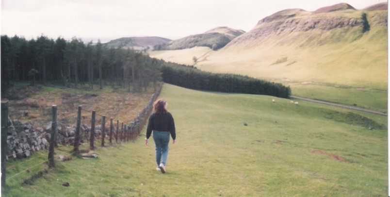
Many years ago I embarked on that elusive journey to find the locations for my book-in-progress, HEIR TO A PROPHECY. I thought Dunsinane would be easy; after all, I only needed to find Birnam Wood, right? Well, imagine my surprise to find two Dunsinane sites…or was it Dunsinnan? There were two locations on the Geological Survey map, both within shouting distance of Perth. So I dutifully visited both hills, expecting – or rather hoping – to find something resembling castle ruins.
Much to my surprise, I found nothing that I could even vaguely recognize as a stone foundation, wall, or any evidence of historic habitation. Where was Macbeth’s castle? I could only assume that Shakespeare loved the sound of the word Dunsinane and really, did it matter if Macbeth built a castle there or not? Yielding to common sense, I located a likely site, Kinfauns castle located on a cliff overlooking the Tay; the current tower was built in the early 19th century as Lord Grey’s architectural folly, but it is thought to be on the site of a medieval stronghold. Good enough for me!
Imagine my relief, after the fact, to discover mention in the book I was reading, BLOODFEUD by Richard Fletcher: “As commander-in-chief of a combined land and sea force…he (Siward) invaded Scotland and defeated Macbeth in a hard-fought battle. (Its site is not known: Dunsinane, properly Dunsinnan, is a later improvisation).” Whew.
I was much more gratified to find the foundations of Malcolm III’s tower at Dunfermline hill, which still stand proudly with a sign and a recognizable footprint…all of three feet high. At least I was on the right track; only 1000 years later, traces of a well-built castle should be identifiable.
Macbeth says:
Dunsinnan hill by Collace has the obvious remais of an iron age hill fort, climb to nearby Black Hill for a clear view.
Mercedes Rochelle says:
Back in the late ’80s when I went, I could have easily found the wrong hill… nothing was marked, no one to ask!
Scott lee says:
Hi, if the photo above is you, dunsinane hill is the one straight ahead with the trees on its slopes. Best access is behind it, where there is a layby and information sign at the roadside. Hope this helps
Mercedes Rochelle says:
Well, that is a pleasure to hear! So I was in the right place after all. Yes, that was me in the early ’80s. I don’t know if there was an information sign back then; if there was, I missed it! It wasn’t the highest hill in the neighborhood, was it?